


Muhammad Ali Pasha
The Syr Darya Basin is one of two major basins belonging to Aral Sea Basin in Central Asia. It has an area of 402,760 km2 divided between four countries; Kyrgyzstan, Uzbekistan, Tajikistan, and Kazakhstan Approximately 20 million people inhabit the basin, of which 73% live in rural areas, making their living from agriculture. 55% of the land is used as pastures supporting livestock of sheep, cattle, goats, horses and camels. 8% of the land is used for crop production. Climate in the basin is hot and arid, only in the mountains the climate is more cool and humid.
The southern part of the basin, where headwaters of Syr Darya are located, is situated in a subtropical climatic zone. The climate here is strongly determined by alpine vertical zonality, and because of that is moderately humid at high elevations to arid at the lower elevations. The northern part of Syr Darya Basin is located in maritime climatic zone and is characterized by extra-continental features. This part of the basin has extremely low precipitation. The average annual temperature in the mountainous part is between -10 to +5 oC, and rises to + 15 oC in the lower desert part of the basin. There is no drastic contrast in the monthly distribution of precipitation. In the lower part of the basin, maximum precipitation is in the cold period of the year, at higher elevations, maximum shifts towards the spring/summer months. In the mountains, annual precipitation ranges from 500-600 mm/yr up to 1500 mm/year in water equivalent. At elevations above 1000 m, i.e. over approximately one third of basin area, a considerable part of precipitation is snow, which forms a continuous cover over significant areas in the mountains during the cold period of the year. Annual precipitation drops to values between 100 and 200 mm/yr in the lower part of the basin. In summer these areas are hot and dry.
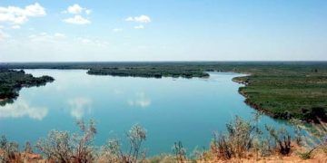
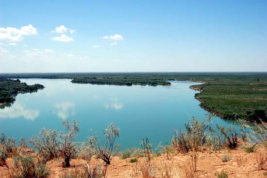
The topography of Syr Darya Basin can be roughly subdivided into two parts: the upper mountainous part, located in Tian Shan Mountains. Here the valleys of rivers Naryn, Karadarya, Chirchik, Arys, and Keles form a network of runoff catchments with a typical alpine pattern of steep and narrow valleys, deeply cut into bedrock. The lower plain part of the basin is basically built up of the erosion products of the nearby mountains, with loess in Golodnaya Steppe and sandy loess-like deposits in Kyzyl-Kum desert. Here the Syr Darya River receives virtually no water from tributaries and has a relatively straight and broad valley stretching in the north-west direction towards the Aral Sea.
The major geomorphologic features of Syr Darya Basin are:
1. Naryn Syrts plateau which is slightly inclined westward at elevations of 2800-3600 m, located in the easternmost part of the basin, surrounded by mountain ranges
2. Alpine ranges over 5000 m in height in the upstream part of virtually all major Syr Darya tributaries. The largest ranges are: Talas Alatau, Kyrgyz Alatau, Terskey Alatau, Fergana range, At-Bashi, Alay, Turkestan range
3. Fergana valley, a waste alpine depression of tectonic origin in the mid part of the Syr Darya basin, located to the east of the Fergana range and encompassed by mountain chains to the north and the south
4. Syr Darya loess-like lowlands, so-called Golodnaya Step’ (Hungry Steppe) at the foothills of Tian Shan mountains in the mid-low course of Syr Darya river
5. Kyzyl-Kum desert in the westernmost lower part of the basin
Among the land cover classes the majority is represented by vegetation of arid and alpine type, like grass and shrubs, covering about 78% of area, forests covers about 8% of basin area and are specific for frontal alpine ranges, exposed to the main wind directions and receiving more precipitation. Swamps make about 7%, bare ground, rocks and other types of badlands contribute up to 5% of the total area, and the remainder includes water and perennial snow and ice.
In total, 280,000 km2 (55% of the basin area) is used as pasture. The livestock is represented by cattle, sheep, goats, pigs, horses and camels. Arable cropland land makes 35,000 km2 (8% of basin area), of that about 80% is irrigated. Gardens, vineyards and other cultivated land are not accounted for. A substantial part of the cropland is located in Fergana valley (administrative regions: Djalal-Abad, Osh, Batken, Andijan, Namangan, Fergana and Sogd) roughly one tenth of the basin area. Here about 55% of the population is concentrated. Major crops in the basin are wheat, potatoes and cotton.
The hydrological regime of the basin is to large extent determined by the climate in the mountains of Tian Shan, occupying approximately one third of the basin area. At the elevations over 1000 m, the period of temperatures below 0oC lasts one month, reaching up to over 6 months at the elevations above 3000 m, where annual temperature is below 0oC. Thus the mountains provide seasonal storage for snow and perennial storage of precipitation in form of the alpine glaciers.
There is a great variety of 34 soil types in the Syr Darya Basin as derived from the Digital Soil Map of the World (FAO, 2002). The dominant soil classes are various Lithosols (I) (covering 31% of basin area), Podzoluvisols (D) (20%), Yermosols (Y) (17%) and Xerosols (X) (13%). Nearly 14% of the basin area has no soil cover, being represented either by bare rock, open water surface, or glaciers. Approximately 18% of the basin area are covered by aridic desert soils (Yermosols, Solonchaks and Solonetz), unsuitable for use either as pasture or for crop production. Shallow and stony Lithosols developed mainly in alpine zone. They are mainly used for cattle pasture. Relatively fertile soils with hydromorphic humidity regime (Fluvisols and Histosols) cover approximately 5% of the basin area and are concentrated along the rivers. Mostly aridic Xerosols, covering 13% of basin area, and in part Gleysols and Podzoluvisols with moderate humidity regime, that cover in total 20% of the basin area, are referred to as “although thin and infertile.
